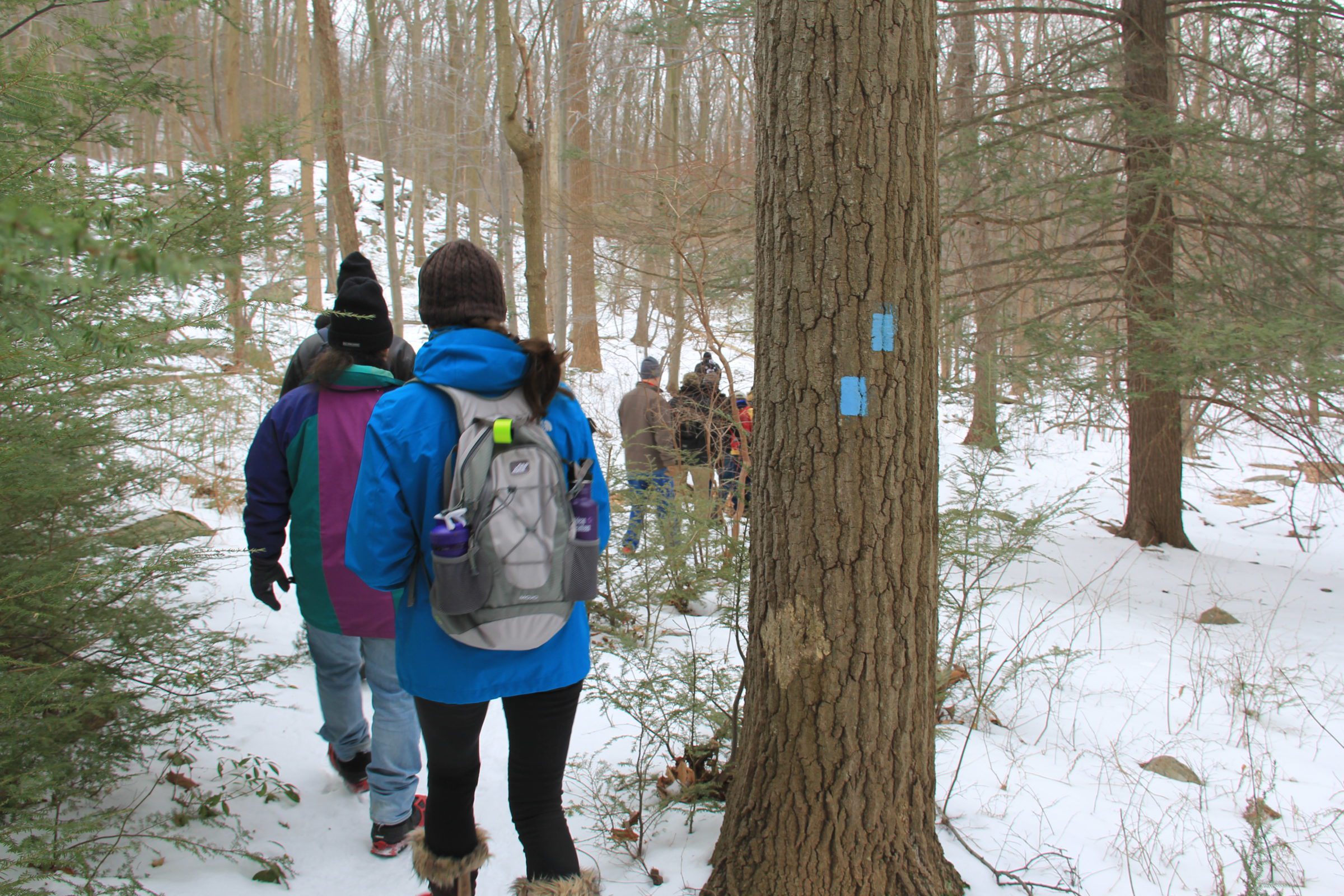
Make your hike as short or as long as you’d like with three easy to follow routes to choose from. Each hike below includes an outlined route on our trail map and step by step directions. We recommend grabbing a hard copy of our trail map located at the information kiosk in the Public Parking Lot to supplement these mini maps below. Remember to dress in layers, bring water, a snack to enjoy out on the trail and practice Leave No Trace principles while out in the Forest.
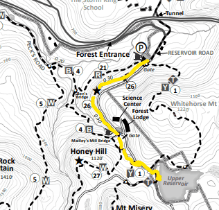
Hike #1: Short “Out and Back” to the Upper Reservoir
To Upper Reservoir (site of proposed pumped storage reservoir for Con Ed’s Storm King power plant proposed in the 1960s) and return: 1.8 miles round trip, 250 foot elevation gain/loss.
Take Sibyl’s Path for 0.6 miles to Mailley’s Mill Bridge, cross bridge and go straight 0.1 miles to intersection, turn left on blue-blazed Reservoir Trail and go 0.1 miles, turn left on yellow Stillman Trail to cross stream onto gravel White Oak Road, turn right on road and go 0.15 miles to the log benches at the Upper Reservoir. From here you can explore multiple trails around the reservoir, or return back to the Public Parking Lot along the same route.
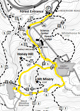
Hike #2: To Upper Reservoir around Mt. Misery and back to Public Lot
Extension of above to see Swamp Trail and Aleck Meadow Pond. Additional 1.6 miles total and 100 foot elevation gain.
From log benches at Upper Reservoir continue along right edge of reservoir on Old West Point Road, an unmaintained woods road for 0.2 miles until you reach the blue-blazed Swamp Trail on right (keep sharp lookout for trail and blazes on right). Take blue-blazed Swamp Trail and continue on it for 0.55 miles, past vernal pool, and intersection with white-blazed Scenic Trail to end at gravel White Oak Road. Turn right and walk road 0.1 miles to gate on left. Pass through gate on old woods road and follow short unmarked trail on the left for about 200ft to beautiful spot at rocky outcrop overlooking Aleck Meadow Pond. Return to gate, turn left on White Oak Road, and follow this for 0.6 miles back to Upper Reservoir. Follow Reservoir road back to Sibyl’s path and finish at the Public Lot.
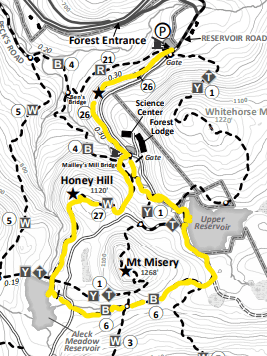
Hike #3: To Upper Reservoir around Mt. Misery and back over Honey Hill
Alternate return from Aleck Meadow to enjoy viewpoint from top of Honey Hill (slightly shorter than previous but with additional 150 foot elevation gain).
From Aleck Meadow Pond, proceed right along edge of reservoir to white-blazed Honey Hill trail on right. Take this trail and follow white blazes for 0.35 miles to top of Honey Hill and view of Black Rock Mountain and valley. Continue on Honey Hill trail past repeater tower for environmental monitoring network and down other side of Honey Hill for another 0.3 miles, proceeding straight through trail intersection and over Mailley’s Mill Bridge, then bear left to re-gain Sibyl’s Path back to the main parking lot. See map below.
Click here to download Black Rock Forest recommended hikes.