Difficulty: Easy, lollipop loop; minimal elevation; mix of gravel paths and trails; about 2.5 miles.
Location/Parking: Public Parking Lot at Reservoir Road; Black Rock Forest, Cornwall, NY
Points of Interest: Areas of dense biodiversity highlighted; Mailley property ruins and Mailley’s Mill Bridge; The Rusty Wagon Bridge; The “Picnic” Rock.
Ecology Narrative & Photos: Terryanne Maenza-Gmelch, PhD, Senior Lecturer at Barnard College Upper Reservoir Trail Narrative: Aaron Culotta, BRF Environment Educator
NOTE: This narrative is a brief ecological guide to some of Black Rock Forest’s most biologically diverse spots. If you are having trouble matching a plant to a photo, or you are curious about a plant or bird mentioned – try downloading the app “Seek” (plants) or “Merlin” (birds) on your cell phone, take pictures and do look-ups as you go!
Reservoir Reflections and Ecology: A Trail Narrative
Begin at the Public Parking lot at Reservoir Road. Welcome to Sibyl’s Path, dedicated to the memory of Sibyl R. Golden chair of Black Rock Forest (BRF) from 2007-2017 (for more info, pause at the entrance kiosk). The first half of this 0.6 mi. path is ADA Accessible, the rest is relatively easy with a steeper grade.
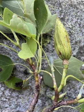
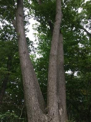
As you proceed, just past the trail entrance, notice the large specimens of tulip poplar (below left and center) and a four-stemmed red oak (below right).

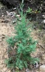
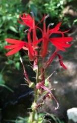
Ongoing efforts to restore the presence of native plants can be seen. On the left, you pass a spillway where cardinal flower (below center) and blue flag iris were planted. These species prefer moist habitats, so efforts have been made to plant them at this particular section of the path near water. Also, along the path you will find areas restored with eastern red cedar (below left) and white pine (below right), two native conifer trees.
The first bench coming up on the right represents efforts to create rest areas on this path which was built primarily to serve community members with mobility challenges.
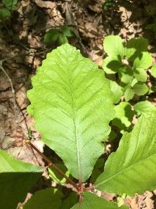
As you approach the second spillway (on your left), you will see two large specimens of chestnut oak on your right. Notice the deeply grooved bark and the shallowly lobed leaves (photos below).

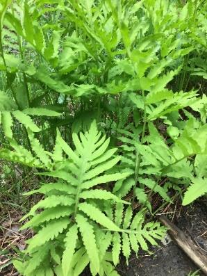
Walk a bit more and look for a large rock outcrop on the left that is covered in polypody fern (photo right). This is a sensitive ecological area because the establishment of the moss and ferns on this rock has taken many decades.
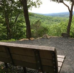
The next bench is situated for viewing a spectacular scene across the Hudson Valley that features Schunnemunk Mountain on your left, towards the southwest and the distant Shawangunk Ridge and the Catskill Mountains ahead towards the northwest. Areas around the bench have been restored with native plants such as woodland sunflower and wild columbine. The trail continues with steeper inclines and offers views of Black Rock Mountain to the right (southwest), best seen in winter without leaves blocking the view.
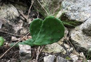
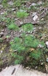
As you continue, on the left notice areas restored with eastern red cedar and eastern prickly pear cactus. The restorative plantings have been undertaken by forest crew, the Garden Club of Orange and Dutchess Counties and members of Woodbury Girl Scouts.
When you hear a stream, you will be coming to the end of Sibyl’s Path. Look to left and you will see ruins of buildings constructed by one of the Forest’s early residents.
In this area, you can also spot Christmas fern, Virginia creeper, oak saplings, and jewelweed along the stream. Notice Japanese stilt grass and Japanese barberry, two invasive species trying to get established here.
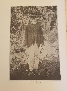
You will exit Sibyl’s Path and turn right to cross over Mailley’s Mill Bridge, named for the family and their mill. James Mealley (original spelling of name) had a farm and business in Black Rock Forest in the 1800s (photo left). Pause here and take a moment to notice this new habitat: a forested ravine with a stream. This small stream supports a thriving food web featuring black-nosed dace (a fish), eastern newt, pickerel frog, water strider and crayfish, among other species. The signature trees here are eastern hemlock, yellow birch, and sugar maple.
Take a minute to listen to the sounds. In spring and summer, you may hear a red-eyed vireo, Acadian flycatcher, eastern phoebe, eastern wood pewee or scarlet tanager at this spot.
As the trail continues straight ahead from Mailley’s Bridge, notice the low markers for our phenology trail – providing information about several plant species. Also note examples of ongoing BRF research: the tower topped by a solar panel on your left serves several point dendrometers which measure tree growth.
At the trail intersection, turn left – onto the Reservoir Trail (blue). Follow the Reservoir Trail until it comes to an end (note the 3 blue blazes forming an upside-down triangle on the tree to the left indicating the trail end) at the small footbridge built by a local Eagle Scout.
Cross the bridge and make a right heading south on the forest road towards the Upper Reservoir. Notice the layers of vegetation: tall canopy trees, understory, shrub, herb and ground layers. These layers create a complex plant architecture that supports forest biodiversity.
Can you point out red oak in the canopy, witch hazel in the understory and mountain laurel in the shrub layer? The herb layer has tree seedlings, ferns, grasses and wildflowers, while the ground layer features mosses, fungi and leaf litter.
Where the yellow trail joins the road from the left, the road forms a bridge crossing over a brook. Take a minute here to observe the rich and delicate herb layer as well as the willows which produce salicylic acid, the active ingredient in aspirin. As you finish this part of the walk notice the variety of tree bark: smooth on American beech, vertical linear on oaks, ash and maples, and horizontal lenticels on the birches. (Lenticels are porous tissues used in plant respiration. The word, itself refers to the often lentil-shape of the opening which appears as elevated bumps on the bark.)
Look ahead and notice the difference in lighting as you emerge from the canopy and the clearing near the Upper Reservoir begins. When you arrive at the reservoir, take a few minutes to pause at the border between the forest and clearing. The big expanse of sky makes it easy to see tree swallows (spring and summer). Also look for eastern bluebirds and American goldfinch at this border any time of year.
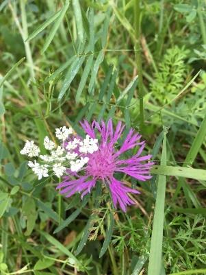
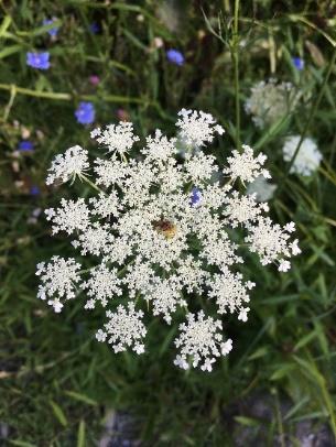
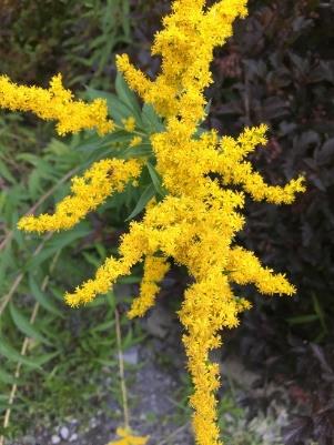
In summer and fall, the perimeter of the reservoir is cloaked in European wildflowers such as oxeye daisy, spotted knapweed (below, left), bird’s-foot trefoil and Queen Anne’s lace (below, center)). Closer to fall, the native asters and goldenrods (below, right) become prominent. The perimeter of the reservoir has a variety of vegetation types: meadow, wetland shrubs and trees, deciduous forest and conifers. This variety in the landscape invites a diverse array of wildlife and makes the reservoir a particularly good spot for birding – keep watch as you walk!
Arrive at the log benches by the reservoir and sit for a moment to view the landscape. This is one of several drinking water reservoirs that serves the town of Cornwall. The water quality is protected by the healthy forest that surrounds it. In the 1960s, this site was the proposed location for Con Edison’s “pumped storage” power plant reservoir. The idea was to flood the forest here with the water pumped up from the Hudson River, hold it, and then release it to create hydropower. Citizen opposition to this was strong and it became a landmark case, the first time in court history in which environmentalists had standing to sue to protect nature.
nstead of continuing on the main forest road, bear left just past the log benches onto Old West Point Road. Take this unmaintained road for about 1/8th of a mile before making a left onto the trail that circles the reservoir (note the sign informing visitors that they are in a public watershed on the left as you turn).
NOTE FOR TRAIL AROUND RESERVOIR: As the trail circles the reservoir some of it is unmarked because it briefly crosses onto Village of Cornwall-on-Hudson and Storm King State Park land – follow the trail that wraps around the reservoir staying within sight of the water, keeping the water on your left. Due to Tropical Storm Isaias in August some areas of the trail had fallen trees or limbs that were recently addressed by the Forest Crew, note the “steps” in one spot and the log cut-out in another.
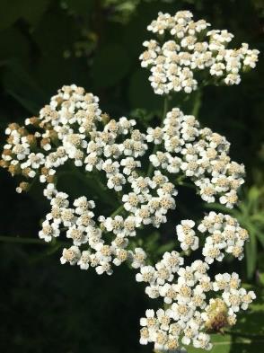
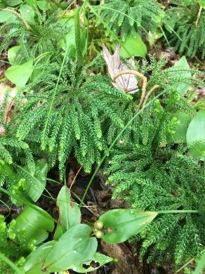
Listen for the gray catbirds and red-winged blackbirds as you follow the trail along the reservoir’s edge. There are many plant species in the herb layer along this road: sensitive fern (below left), yarrow (below center), hay-scented fern, club mosses (below right) and more.
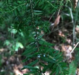
You will encounter the Rusty Wagon Bridge built by students from the Metropolitan Montessori School, shortly after turning off Old West Point Road. The wagon pieces on display were found during the construction of the bridge, hence the name. Take a deep breath and enjoy the small stand of eastern hemlocks at this location. Can you find any of the hemlock wooly adelgid (photo right) – white egg masses on the hemlock branches between the needles and twig? This is an invasive, aphid-like insect that attacks North American Hemlocks.
After continuing along the path you will reach a large flat rock, almost directly opposite the benches – this is known as the picnic rock and is an ideal setting at which to have lunch or trail snacks and watch for birds (remember to leave no trace and carry out what you carry in).
As you continue past the picnic rock you will notice the thick huckleberry and blueberry that line the trail, with a dominant oak forest canopy overtop. This habitat type can be found throughout most of Black Rock Forest. These fruit bearing plants produce both food and cover for native birds, squirrels, black bears, and whitetail deer.
When crossing the small feeder stream at the east end of the reservoir, be sure to acknowledge the small scrubforested wetland that borders the stream. This wetland area provides structure to the soil which prevents erosion and enables a variety of habitat layers for native wildlife.
Continue along the trail as you make your way to the connection with the Stillman Trail on the northern side of the reservoir that is blazed in yellow and teal. Bear left on the Stillman Trail. As you walk along this trail, be on the lookout for native white pine seedlings that have been dispersed by a larger, mature white pine on the nearby hillside. Tree seedings and saplings are a great bioindicator of healthy forest regeneration, further illustrating the work of forest managers and BRF staff over the past several decades.
Once you have reached the main forest road, take a right and head back down towards the Public Parking Lot. After roughly 1⁄4 mile you will see the entrance to Sibyl’s Path on your left. Continue down the path to your vehicle where your hike began.
Click here for a downloadable version of this trail guide.